 |
| Home | Geography | History | Biology | Recreation | News | Resources |
| Timeline | Narrative | Events | Places | People |
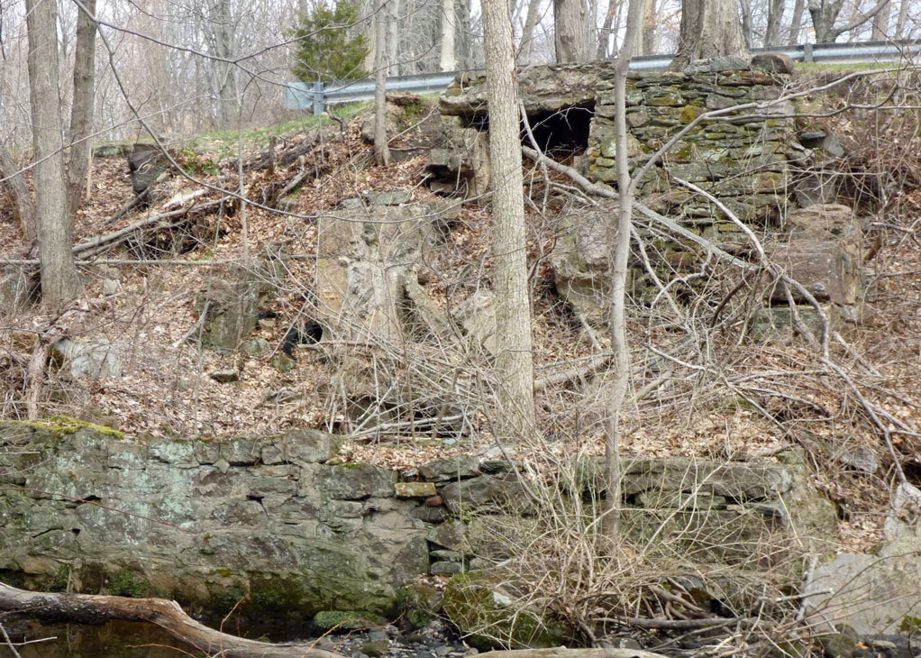
Tunnel Road MillThere was a mill on the Tankerhoosen River on Tunnel Road. It's visible from the road during Winter but I suspect few have noticed it or given it much thought. I've lived in the neighborhood for over 50 years and its been a puzzle as it isn't mentioned in any of the town histories.
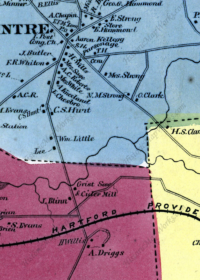
The 1869 town map shows the saw and grist mill located on the east side of the road and south side of the river. Saw and grist mills came to the area with the earliest settlers as they were essential to the community, but because they were common aren't studied like cotton and weaving mills. They were often owned and operated by families rather than companies so don't have the involvement of the prominent and wealthy families. The first such mill in the Tankerhoosen Valley was at Valley Falls. Beginning as a saw and grist mill it was later converted to a cotton mill and attracted investment money from other mill owners in town. Many of the larger mills along the Tankerhoosen River began as saw and grist mills such as those at Phoenixville and Dobsonville. The Tunnel Road mill is unusual as there is not a significant drop in river elevation at this location and it seems to have been built at a time when small saw and grist mills were vanishing or being converted to the more prosperous cotton mills. Perhaps that is why a farmer decided to build a saw/grist mill during the Civil War - there was still a need, but fewer mills to fill that need. As I've researched the Tankerhoosen Valley over the past few years the Tunnel Road Mill has been a puzzle as other than the 1869 map it doesn't seem to appear in any town histories and I've been unable to find with certainty an owner's name - until recently. Click on photos for full size images. Stories and HintsNorman Strong drew a rough series of maps of Vernon Center, including Tunnel Road, drawing on the published maps and his memory of growing up and living in the area. His 1925 map identifies the Tunnel Road mill as 'Kanter's Grist Mill.'
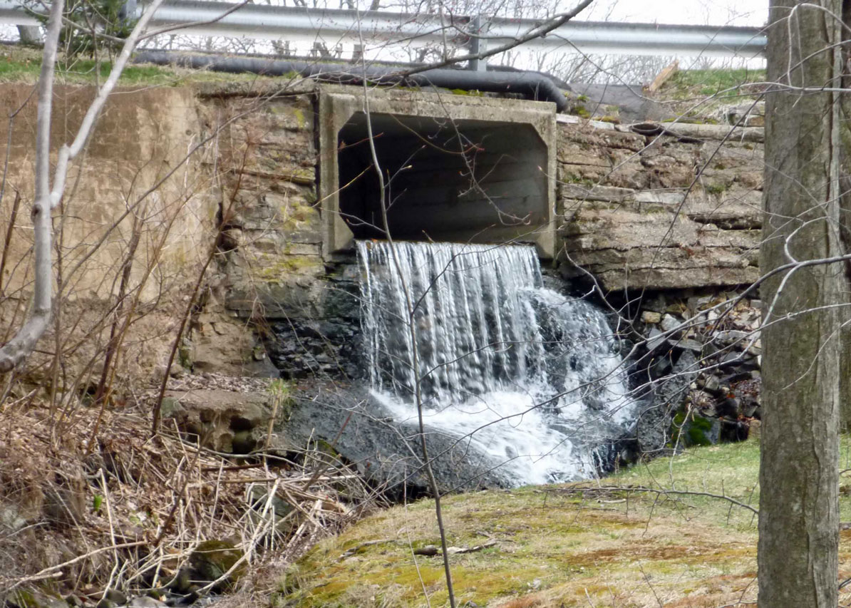
The Kanter's were one of the Jewish farm families locating in the Vernon and Ellington area in the early part of the Twentieth Century. Their farm was about where Exit 66 is today and as they became successful purchased neighboring farms and were one of the first in the area to grow tobacco. Jean Kanter Klothe grew up on the farm in the 1910's and 1920's and in 2005 wrote a memoir of her childhood for the Vernon Historical Society. In her memoir she describes in detail her life in each season of the year. If her father owned and operated a grist or saw mill this should have been part of her narrative. However, she only mentions visiting the mill late in the summer with her father to make cider. More on the Kanter connection later. The other narrative about the mill that comes down to us is from Geraldine Risley Strong, Norman's wife, who grew up in the farm house just south of the mill on Tunnel Road. The Risley's bought the house in 19?? and Geraldine recalls her father's warning her to stay out of the abandoned mill because it was deteriorating and dangerous. Sure enough she remembers the mill collapsing during a storm, probably the hurricane of 1938. So what we know is that the mill was in existence in 1869, over the years was used as a saw, grist and cider mill and was still being used at least minimally in the 1920's, but was abandoned and collapsed in the 1930's. The Site TodayJust next to the road is the stone foundation of the mill. During Winter months it is visible as you drive by, but is obscured by brush in the summer. The walls are gone and likely carted away and used for other projects but enough of the foundation remains to judge the size. There is no rise in the river at this point that might have been dammed for a pond to provide water to a wheel. There is, however, a wall and berm on the south side of the river and an indication of a small pond above the mill. The pond appears to have been fed by a canal or head race suggesting a dam well upstream directing water to the mill. The valley floor upstream is fairly flat and wide with a wall on the south side just north of the Valley Falls Cemetery. The area is overgrown today with multi flora rose and its thorns and other shrubs make exploration challenging. To date no photographs or sketches of the mill have been located although it is very possible they exist as the mill survived into the late 1930's. In March 2016 Dick Symonds explored the site as research for his "Mills of Vernon and Rockville" book and read the landscape drawing some of the conclusions mentioned above.
History Of The SiteTunnel Road seems to have been one of the earliest roads in North Bolton being the shortest route from Vernon Center to the settlers' church in Bolton Center, seven miles away. To see the area as the first settlers saw it there was neither I-84 nor the railroad; just farmland sloping down to the river from Vernon Center and then the steep rise up the hill beyond to Lake Street. This site may have been chosen as it was shallower than downstream and could have been more easily forded. Bolton was divided by its fifty proprietors in the 1720's with each first taking a 100-acre homelot, then a 50-acre lot, then 25-acres through 12 divisions. The choice farm land was in south Bolton where most chose their homelots but later lots were chosen in North Bolton planning ahead for sons and grandsons. Some families wound up with large tracts they added to as others moved on. Some of the earliest settlers on Tunnel Road in the Tankerhoosen Valley were: Vernon separated from Bolton in 1818 but we don't have a good map until 1853 which shows a house on the west side of Tunnel Road just south of the river owned by ? King. He likely owned and farmed much of the area. The King family at one time owned much of the northeast part of Vernon and are best known for King's Tavern at Lafayette Square. At the time the Tunnel Road mill was built Rockville was a booming town with many large mills. Talcottville, Phoenixville and Dobsonville were also doing well and even the Valley Falls Mill was manufacturing cotton. The only other active saw or grist mill on the Tankerhoosen may have been Walker's Mill well upstream. Blinn likely continued to farm with the mill as a side business, but its construction had to be a major effort and expense. In 18?? Blinn sold his house, farm and mill to ??. The deed has a description of the mill and its equipment. The Mill OwnersThe mill had many owners between its first use in 1863 and its collapse in the 1930's. It began as a saw, grist, and cider mill and although it was likely expanded and rebuilt over the years, unlike many of the other mills on the Tankerhoosen, its purpose was consistent. The families that owned and operated Tunnel Road Mill were primarily farmers and were likely only marginally successful as mill operators. This then is a glimpse of some of the people who settled, farmed and worked in the Tankerhoosen Valley. Isaac Blinn: The builder of the Tunnel Road Mill appears have been Isaac Blinn in about 1863. The 1857 map shows the same house owned by Blinn but does not show a mill. Blinn was a farmer and seems to be the most likely person to have built the mill in about 1863. The evidence for Blinn's building the mill is an 1863 deed giving him the right to overflow an area of ????'s farm for his mill pond at the head of a canal. Blinn would have had to get this permission before he could have put a mill into operation so 1863 was about the time of construction. As ??? was paid only $1 he must have been on good terms with his neighbor and perhaps agreed to grind his grain for free. ???? Babcock Cox Phelan Kanter
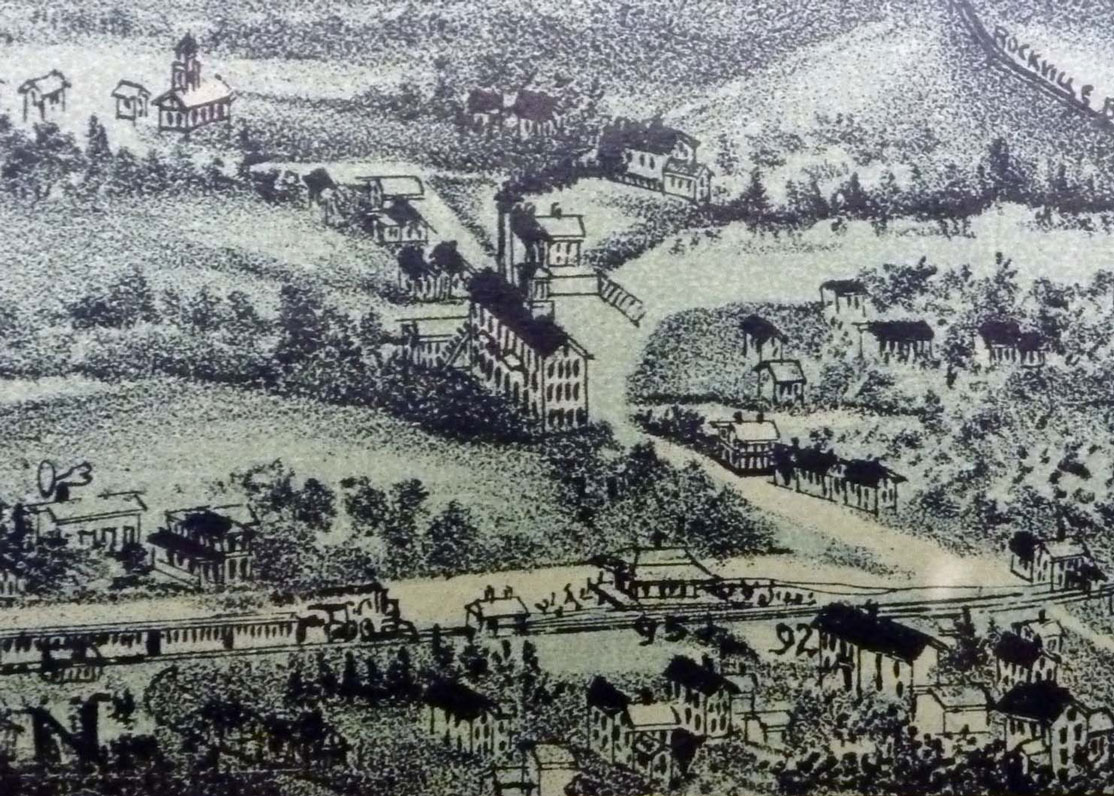
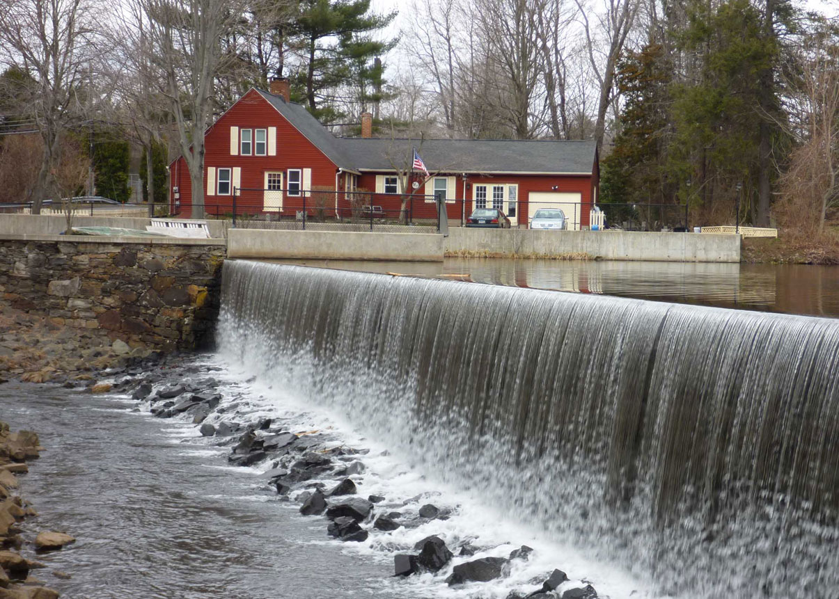
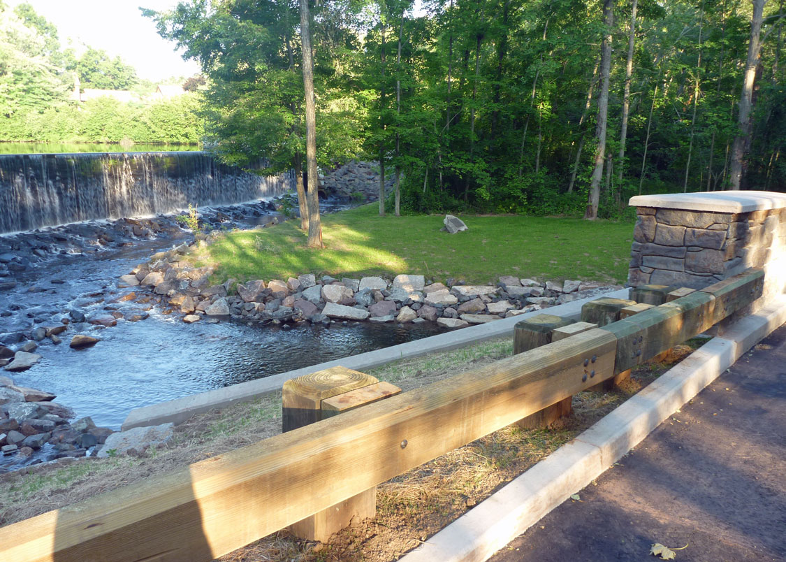
The Area TodayThe primary feature of the area today is the Tankerhoosen Lake dam, the only dam in the Tankerhoosen Valley visible from the street and arguably the most scenic. For those who like statistics Tankerhoosen Lake is the largest in the Tankerhoosen Valley with a normal surface area of 16.5 acres, draining an area of nearly 11 square miles and is owned by the DEEP. The dam is masonry, of earthen construction with a height is 16 feet and a length of 237 feet.
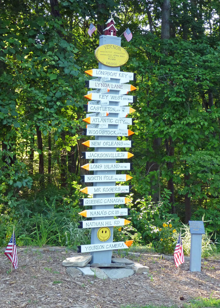
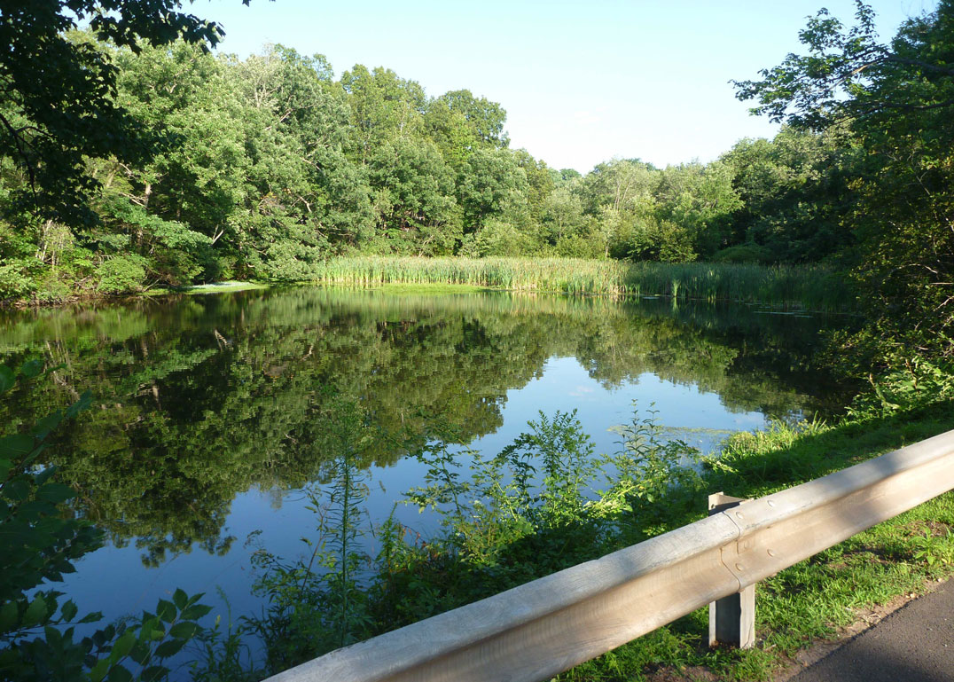
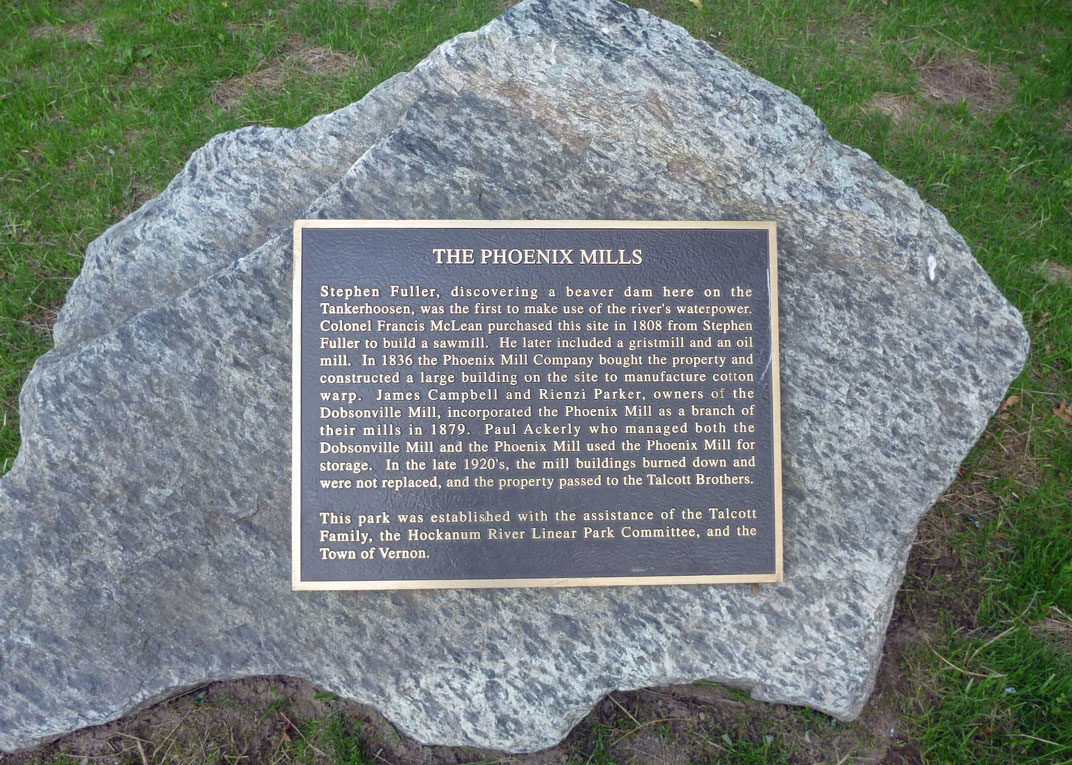
Near the dam and lake is a small park owned by the town of Vernon. Below the dam the park contains an historical marker with the area's history. Above the dam and next to the lake are benches. It's a good place to teach children how to fish. In recent news the circa 1940 bridge over the Tankerhoosen River was replaced at a cost of $1.1 million with a new bridge opening in July 2012. The stone design of the new bridge nicely complements the area. The mill pond still exists and is today part marsh, frequented by ducks, geese and an occasional egret. The channel from lake to pond is now a parking lot. West of Phoenix Street and down the bank are remains of the mill including old walls and water channels. Nearby is another unique feature - a homemade direction sign and fancy bird houses built by neighbors Bill and Dave. The current residents of what was once Phoenixville take pride in the area helping to maintain the park and beauty of the area. OtherLocal papers provide a glimpse of mill life. From a 1913 Rockville Journal column: "Mr Houle and family have moved from Andover into one of the Ackerly tenements in Phoenixville. Mr. Houle has entered the employ of Paul Ackerly." "Paul Ackerly's auto truck, which was badly damaged by accidentally catching fire last fall, has been completely rebuilt and is in commission again." "Joseph McCrystal, who had his left hand caught in the gears while attempting to open the water gate at the Phoenix Mill pond last Thursday evening, had to have one joint of one finger amputated. Two other fingers were badly lacerated and bruised." Sources"Cascades and Courage" by George S. Brooks, 1955, 529 pages. This is the classic local history book. The entire text can be found and searched online. Scott Lent's Vernon Depot, Dobsonville and Mills website. (1883). The Historical Statistical and Industrial Review of the State of Connecticut, Part I. W. S. Webb & Co. Detail review of businesses including mills. The link is just to the Vernon and Rockville section. Page 264 has a description of the Phoenix mill. FindLakes.com - Information on CT lakes.
| ||
Home | Activities | News | References | Search | Site Map | Contact Us © Copyright The Tankerhoosen. All rights reserved. |