 |
| Home | Geography | History | Biology | Recreation | News | Resources |
| Overview | Detail | Geology | |
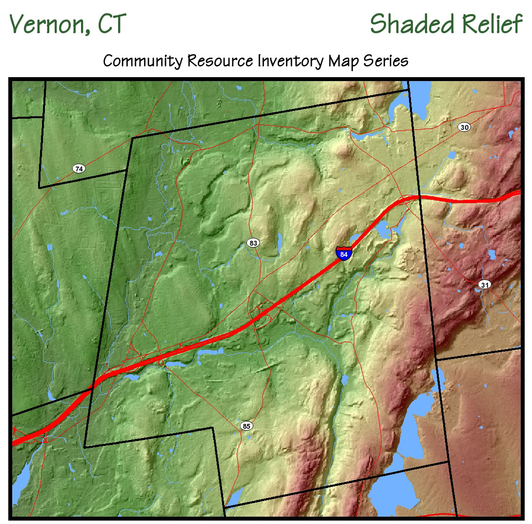
Geography
How large is the Tankerhoosen Valley and what is included in its boundaries? What would you find in a journey down the river? How many lakes and dams would you encounter? What tributaries flow into it? What features will you find? How was it shaped? What geological forces created it and when? Click the map for a pdf file with a legend. These are the questions we hope to answer in this section. You can start with the Overview for a quick understanding of the valley. Under Detail you will find a longer, more detailed description and links to pages on the major areas as we develop them. Under Geology we will explain what you see and how it was created. We welcome your ideas and contributions too. Tankerhoosen - What's In A Name?Where does the river's name come from and what does it mean? Why do you find so many different spellings? And where is the only road crossing with a sign indicating it is the 'Tankerhoosen River?' Bits of trivia about the Tankerhoosen. » Go to Tankerhoosen - What's In A Name? OverviewThis section is an overview of the Valley to give you an idea of the extent and the major sections and tributaries. Detail DescriptionIn this section you'll take a trip down the Tankerhoosen as well as explore its major tributary the Railroad Brook. Over time we'll visit, describe and explore each area you'll encounter along the way. Major ParcelsThe Tankerhoosen Valley includes several major parcels that preserve the land and river. Exploring them is another way of coming to know and understand the land. They include the Tankerhoosen Wildlife Management Area, the Belding Wildlife Management Area, Valley Falls Park and the Talcott Ravine. Features & HighlightsVisit this Google Map showing the location of features and highlights you'll find in the Valley. Includes a short description of each. Use this to plan your visit and locate places. » Go to Tankerhoosen Valley Google Map
GeologyThe Tankerhoosen Valley was formed from the collision and separation of tectonic plates; the scouring of glaciers and the remnants of their melting; many years of wind, rain and runoff; and finally the hand of man made the final changes. |
Home | Activities | News | References | Search | Site Map | Contact Us © Copyright The Tankerhoosen. All rights reserved. |