 |
| Home | Geography | History | Biology | Recreation | News | Resources |
| Activities | Trails | Places |
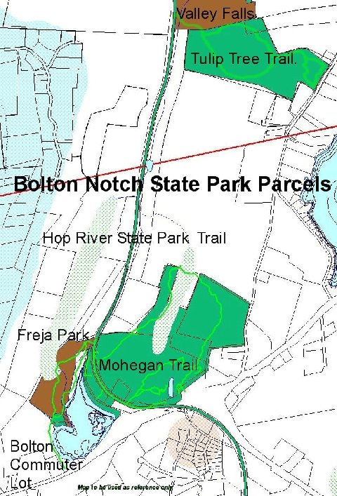
Tulip Tree Trail
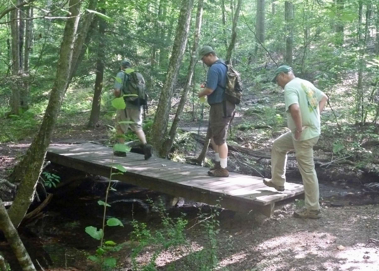
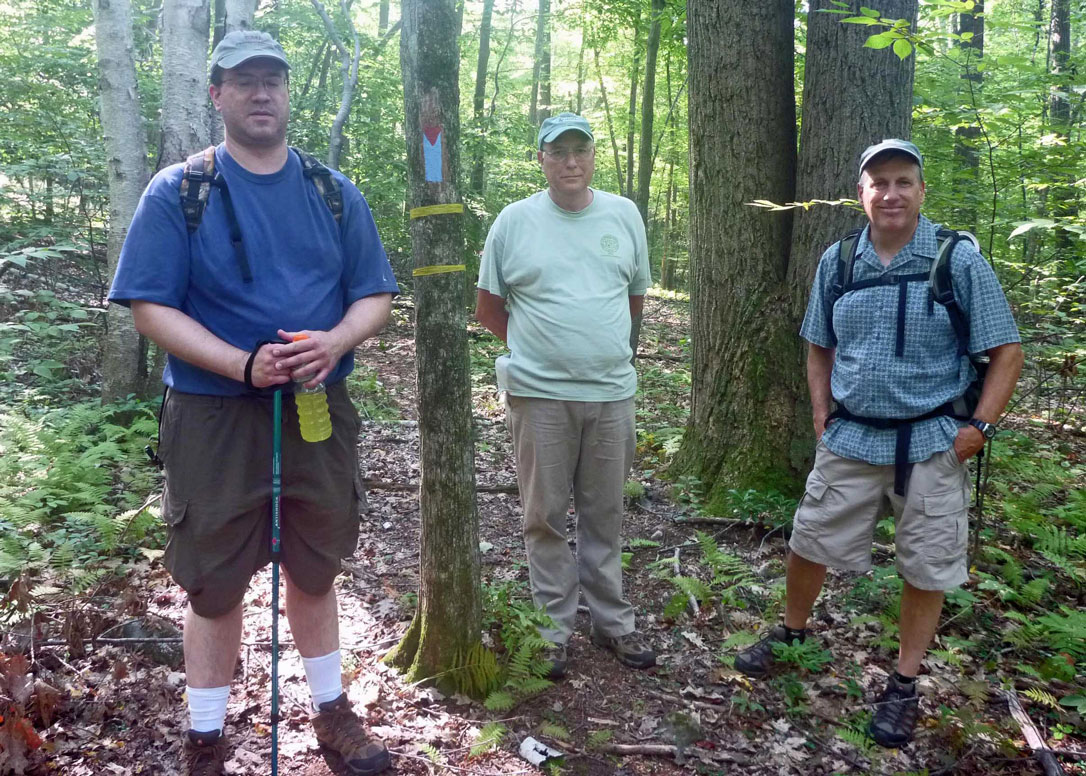
This is the area's newest trail opening in 2012. It was designed, developed and is maintained by the Bolton and Vernon Conservation Commissions. In September, when these photos were taken, the hike was lead by Bolton's ROD PARLEE and Vernon's RYAN GOAD. It begins at the south end of Valley Falls Park near the Vernon/Bolton line and is a loop from Railroad Brook to Bolton Road and back. The hardest part of the trail may be finding it. The beginning is roughly halfway between Bolton Notch and Valley Falls Park, such that you can approach it along the Rail Trail from either direction.
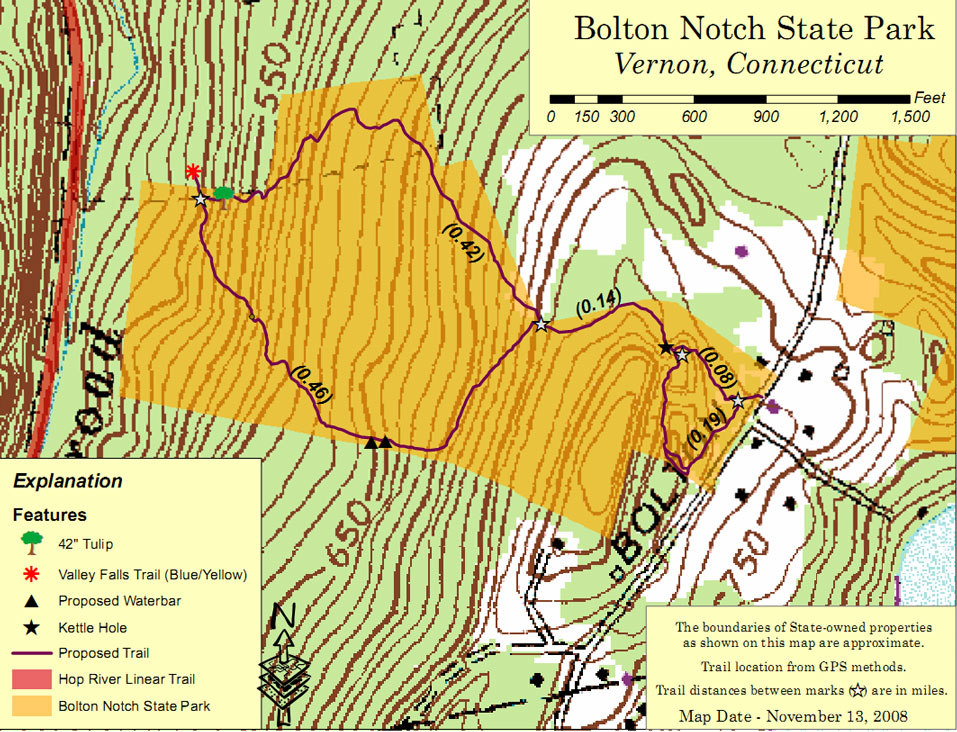
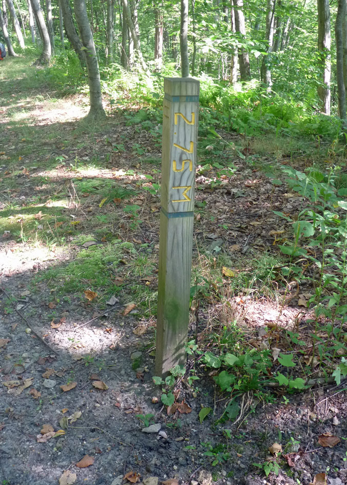
You can also reach the entrance by following the trail along Railroad Brook from Valley Falls Park. From either direction its a good mile to the entrance adding two miles to the round trip. From the Rail Trail look for the 2.75 mile marker. Nearby you'll find a trail descending into the valley. It's marked with a blue/yellow blaze and currently with a green ribbon. Along the way you'll see reminders of the railroad. The trail crosses a bridge over Railroad Brook heading east across the valley floor. The start of the Tulip Trial is clearly marked with its own tulip tree blaze. The blue/yellow trail continues north to Valley Falls Park. Click on photos for full size image. » Read more about the Tulip Tree.
Tulip Trees
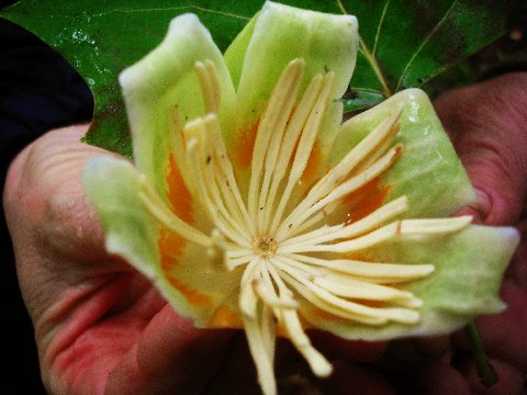
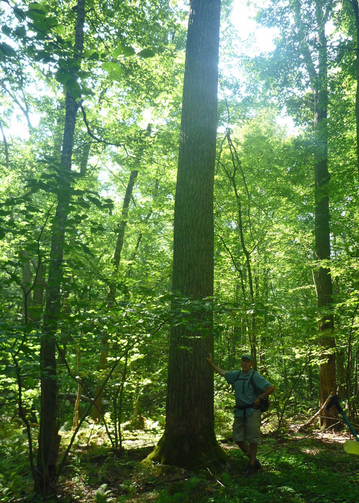
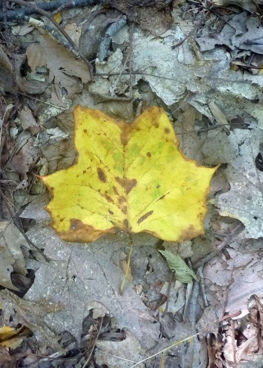
The unique feature of this trail is a series of Tulip Trees (liriodendron tulipifera), which legend tells us were planted long ago by Native Americans to mark their territory. Most of the 'River Indians' lived in long houses or wigwams, made from bent saplings covered with tulip tree bark. Native Americans also used the tree for dugout canoes. One older common name is 'canoe tree.' These particular trees, however, were planted by the Darico's at the request of the Beach family. Tulip Trees are tall and very straight with branches beginning above the tree line of most other trees. They are found throughout the state with heights to 150 feet. One of the largest in the state is located in South Windsor. The tree's wood is soft, light and straight grained making it a desirable lumber species. The sapwood is white and the heartwood has a greenish color. The wood does not shrink or warp easily, takes nails without splitting and is very durable. One source states that it is resistant to termites. Liriodendron trees are easily recognized by their leaves, which are distinctive, having four lobes in most cases and a cross-cut notched or straight apex. Leaf size varies from 822 cm long and 625 cm wide. Once you learn to identify the tree you will see them in the valley from the Rail Trail as well as along the path. » Read more about the Tulip Tree.
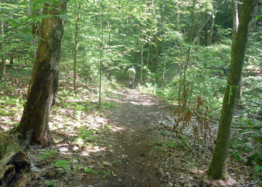
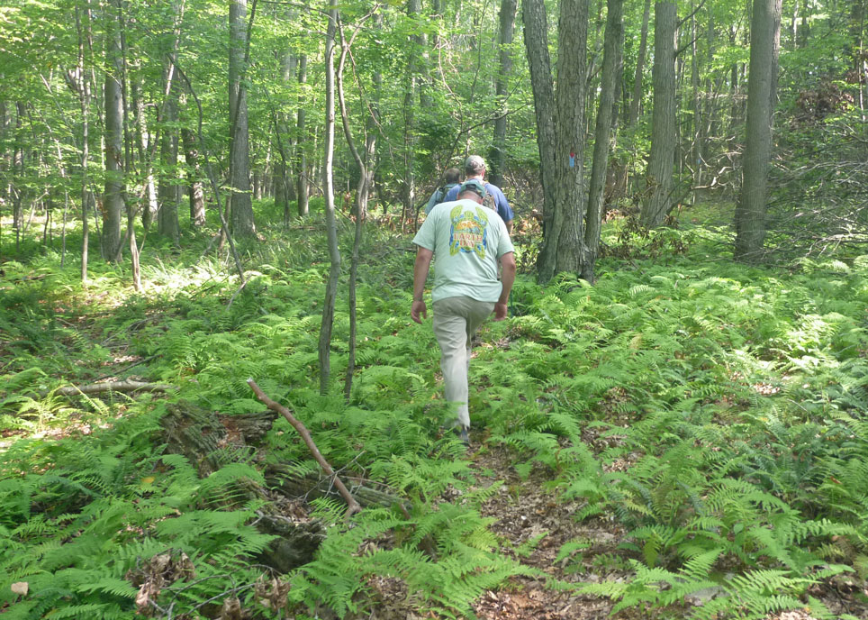
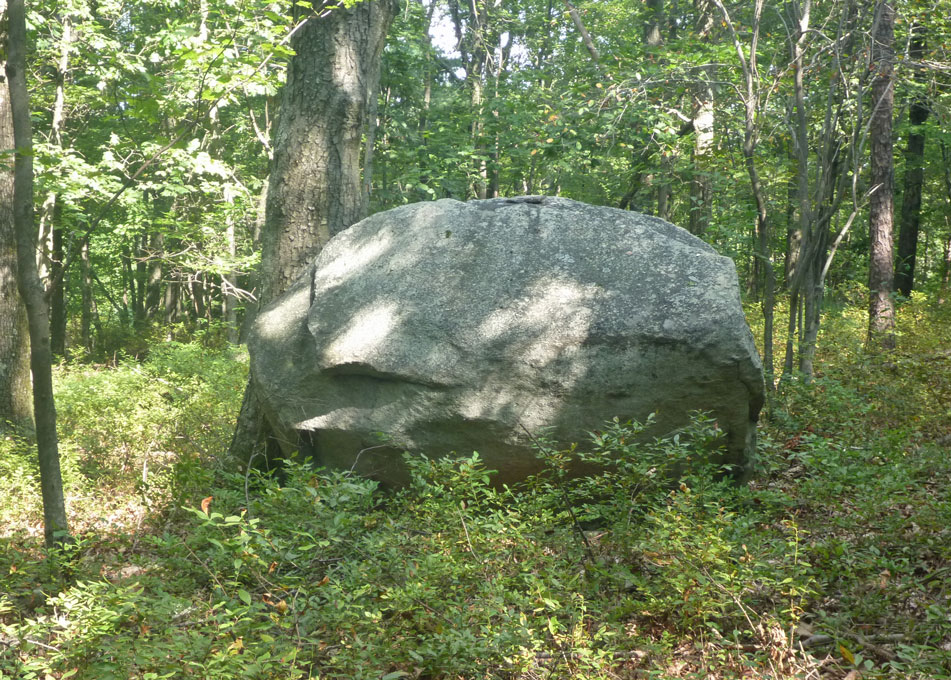
Along The TrailThe trail is marked with a special symbol representing the tulip, but with limited traffic is not well worn. Other than the Railroad Brook area, where there is a bridge, it is quite dry. As you'll go up the side of the valley it's a moderate level hike. Most of the trail up the hillside is open woodland and isolated from human noise. Tucked well away from major highways and housing the only road in the area is Bolton Road and this can be quiet for long periods. We heard no cars, no dogs, only the sounds of birds and breeze. This level of peace and quiet is rare in the Tankerhoosen Valley. Look for glacial erratic boulders, stone walls, ferns and mushrooms.
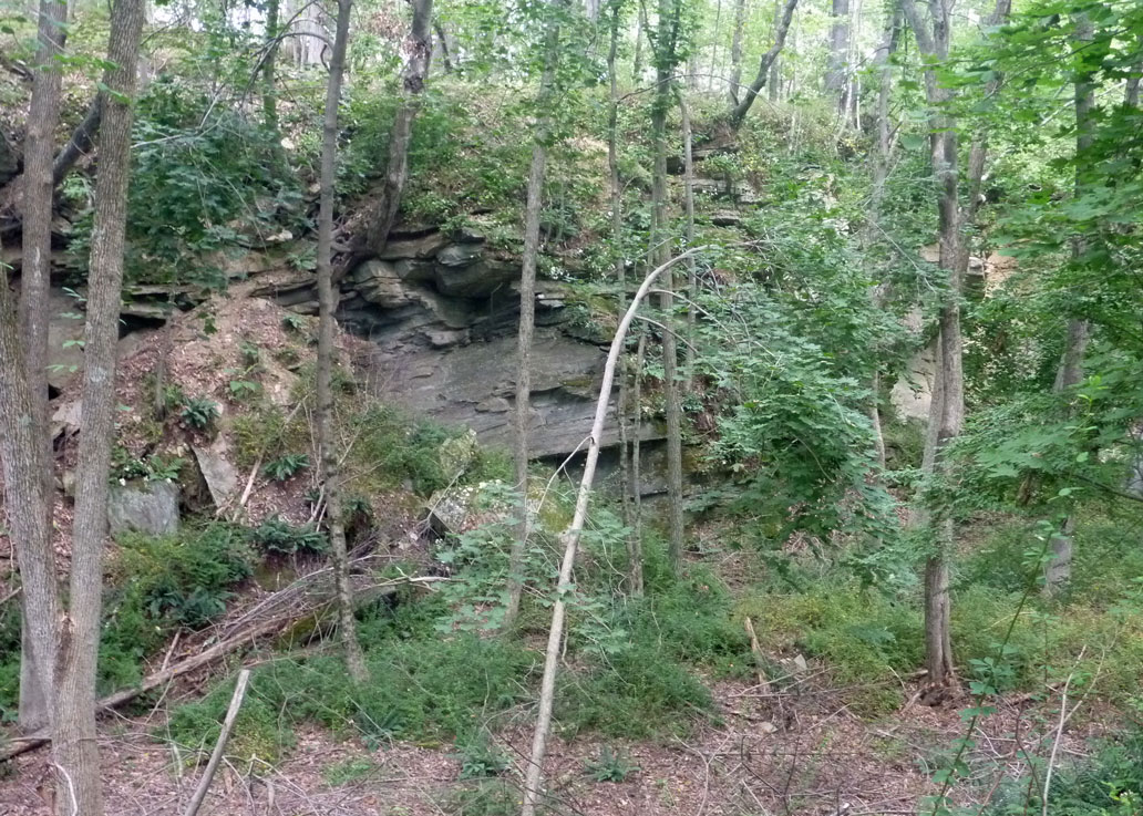
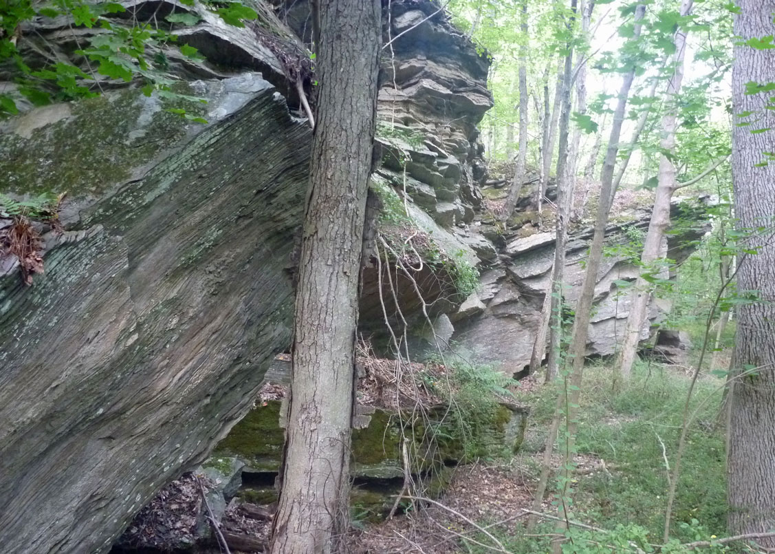
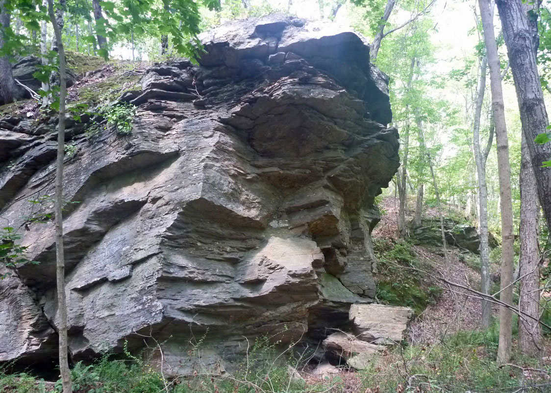
The most interesting feature on the trail may be the rock ledge and small quarry at the top the hill not far off Bolton Road. Nearby on private land is a larger, still active quarry. The Eastern Highlands, of which most of the Tankerhoosen Valley is a part, were created by the joining and separating of tectonic plates millenia ago. The ridges run mostly north-south and outcropping are especially obvious along the Rail Trail on the western side of the Railroad Brook valley. Climbing the western ridge up Box Mountain shows a series of tiers and outcroppings. These are less evident on the eastern or Bolton Road side, but can be seen near the top of this ridge and as you descend to Bolton Lake. This is why you find quarries along the Bolton Road ridge and in the Bolton Notch area.
Caution
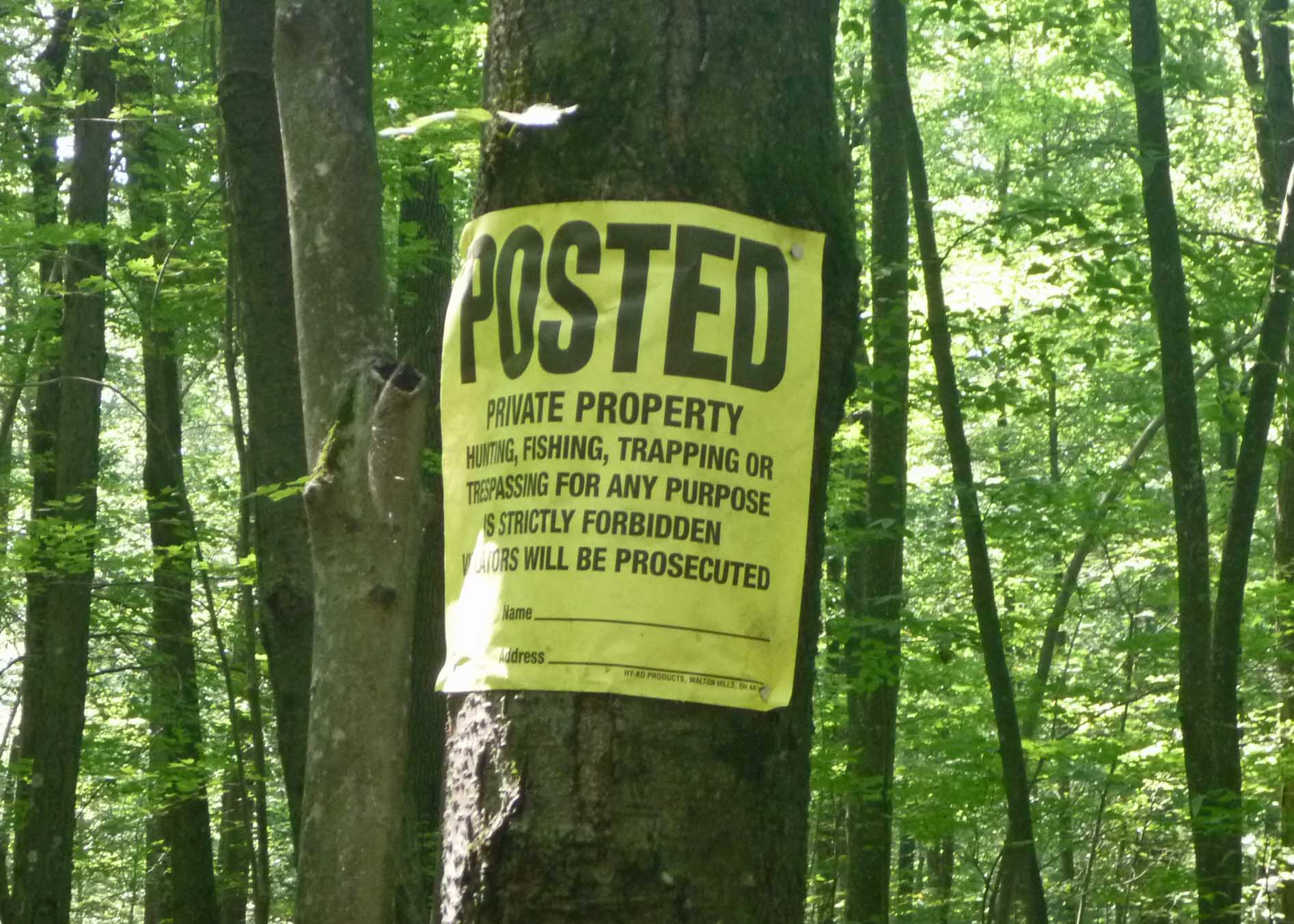
The southern part of the trail loop (Bolton side) is close to the property line of a quarry which is clearly marked as private property. Although the sign indicates no hunting is allowed the owner does permit some hunting on this property with permission. Please stay on the trail and during hunting season be alert and wear bright colors. | ||
Home | Activities | News | References | Search | Site Map | Contact Us © Copyright The Tankerhoosen. All rights reserved. |