 |
| Home | Geography | History | Biology | Recreation | News | Resources |
| Organizations | References | Preservation | Glossary |
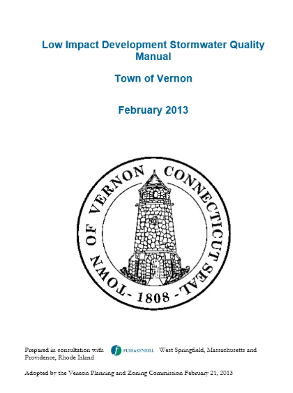
Low Impact Development (LID)In April 2013 the Town of Vernon's Planning & Zoning Commission approved Vernon Planning Department applications requiring consideration of Low Impact Development (LID) techniques as described in Vernon's LID Stormwater Quality Manual. It applies to site design for both commercial and subdivision applications. The LID Stormwater Quality Manual was adopted earlier at the PZC's February 21 meeting. This concluded a 2 year study begun in February 2011. What is LID?
LID is about stormwater management. It is an innovative approach that uses the basic principle modeled after nature: manage rainfall where it lands. LIDs goal is to mimic a sites pre-development hydrology by using design techniques that infiltrate, filter, store, evaporate, and detain runoff close to its source. Techniques are based on the premise that stormwater management should not be seen as stormwater disposal. Instead of conveying and managing/treating stormwater in large, costly end-of-pipe facilities located at the bottom of drainage areas, LID addresses stormwater through small, cost-effective landscape features located at the lot level. LID is a versatile approach that can be applied equally well to new development, urban retrofits, and redevelopment projects. By implementing LID principles and practices, water can be managed in a way that reduces the impact of built areas and promotes the natural movement of water within an ecosystem or watershed. Applied on a broad scale, LID can maintain or restore a watershed's hydrologic and ecological functions. LID begins with a site planning process that first identifies critical natural resource areas for preservation. Then, once the building envelope is established, LID techniques, such as maintaining natural drainage flow paths, minimizing land clearance, clustering buildings, and reducing impervious surfaces are incorporated into the project design. Why do we need regulations?Development pressure in the Tankerhoosen watershed, particularly at Exits 66 and 67, poses a threat to the long-term health of the Tankerhoosen River and other water bodies. Water quality in the lower, more densely populated section of the Tankerhoosen has been impacted by development and land use activities in that area of the watershed. This section, downstream of the Phoenix Street bridge, does not meet DEEP water quality standards for aquatic habitat. The high water quality in the upper section, from the bridge upstream to the headwaters near Walkers Reservoirs, is threatened by uncontrolled stormwater runoff associated with future development. Incorporating LID regulations is a key recommendation of both the new Plan Of Conservation & Development and the Tankerhoosen Watershed Management Plan. Study goalsDraft low-impact development regulations and a corresponding design manual for Vernon. This includes reviewing current town regulations and ordinances for impediments to LID. How was the study funded?The study was funded by a $26,000 grant from the National Fish and Wildlife Foundation (NFWF), Long Island Sound Futures Fund. The grant was awarded to the Friends of the Hockanum River Linear Park and project partners: the North Central Conservation District, and the Town of Vernon (Planning Department, and Planning & Zoning and Conservation Commissions). The grant was one of 38 awards given for community-based projects in New York and Connecticut to improve the health and vitality of Long Island Sound. The Tankerhoosen River study is the furthest inland project and shows the importance of our small river to state and federal officials and its importance to the restoration of Long Island Sound. The grant is the third NFWF award received by the Friends and collaborating organization in support of Tankerhoosen River protection. The first award funded a comprehensive water quality study of the river. The second award funded the Tankerhoosen Watershed Management Plan. The Plan detailed recommendations and actions that can be undertaken by both government agencies and residents to protect the high quality of the waters flowing in our Tankerhoosen River. Process & Results
The LID project held its kickoff meeting in April 2011. Three other meetings were held during 2011 to provide input to Fuss & O'Neill and feedback on their material. Three material sets were produced and reviewed. On April 26, 2012 a public presentation to town officials and to the public was held culminating the year long project to develop LID regulations and an LID design manual. The next step was for the Planning & Zoning Commission working with the Town Planner's office to review the results and recommend specific changes to our zoning regulations. This resulted in the PZC's adoption of the LID Stormwater Manual on February 21, 2013 and approval of regulation changes on April 18, 2013. The following pdf documents were developed by Fuss & O'Neill as part of the project work scope. Examples of LIDHere are a few of the areas considered in developing regulations. It's important to have reasonable solutions for developers and have them consider LID solutions during the design phase of a project.
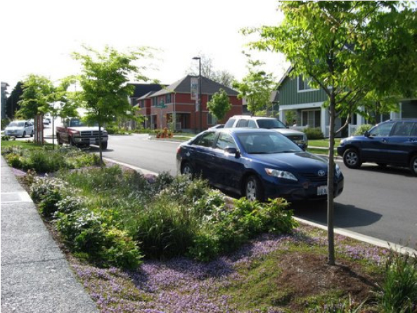
Tree Protection: Large trees with leafy canopies intercept rain and reduce runoff. Their root systems absorb nutrients and help to provide for water treatment. Where an undergrowth is allowed to develop there are several layers of protection. Adapting Impervious Surfaces: Pervious just means open to passage or entrance so an impervious surface is one that carries rain water away from the area as do most asphalt parking lots and driveways. Pervious materials and construction can be more expensive for the builder so it is important to provide options. Important considerations are limiting the size of parking lots and driveways, disconnect sections of a parking lot, and use vegetative channels rather than hard piped drainage systems. Islands and Buffer Strips: The ideal way to treat stormwater is to capture it in natural landscapes before it concentrates into rivulets or streams. Landscape islands and buffer strips can do that before it leaves an impervious area or development site. What you can do at home
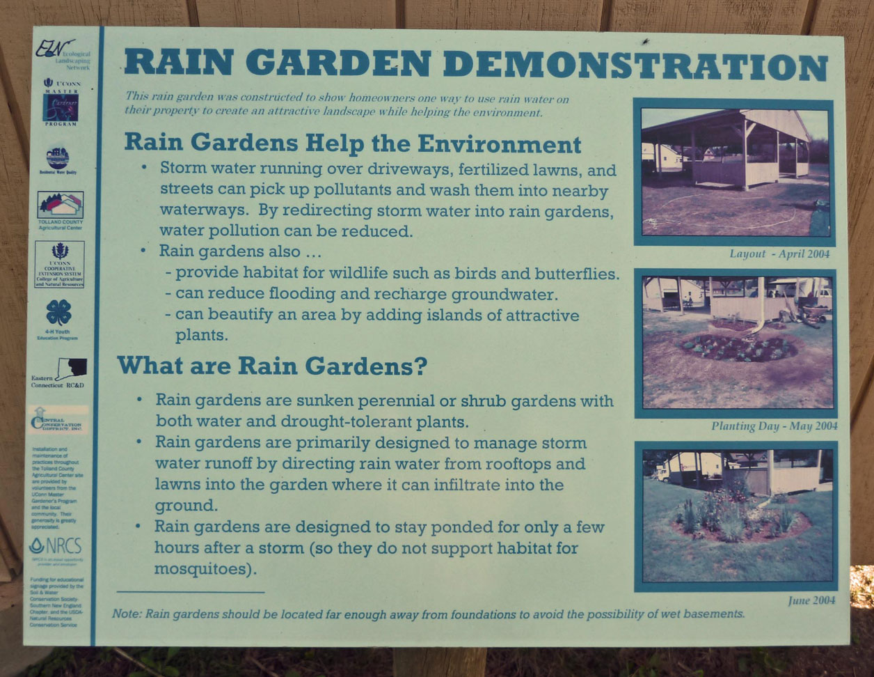
Although LID techniques focus on new construction and improving urban landscapes there are also things you can do where you live. Where does your rainwater go? Into the street or a nearby stream? Does it carry fertilizer or pesticides with it? The goal is for it to go into the ground as close as possible to where it falls. Direct it onto the lawn or into the woods. Rain gardens are an attractive way to capture runoff as is an above or in-ground rain barrel. At the Tolland Agricultural Center on Route 30 you can see several examples. Also see Rain Garden Design. When paving consider a pervious or porous surface. Candidates are porous cement concrete, porous asphalt concrete, gravel pavers, grass pavers, variations on different types of grids and blocks, and loose aggregate. See Pervious Pavement. ReferencesLearn more about Low Impact Development at these websites: Wikipedia Low-Impact Development. Tankerhoosen River Watershed Management Plan Massachusetts Smart Energy Toolkit. U.S. Environmental Protection Agency. |
Home | Activities | News | References | Search | Site Map | Contact Us © Copyright The Tankerhoosen. All rights reserved. |