 |
| Home | Geography | History | Biology | Recreation | News | Resources |
| Activities | Trails | Places |
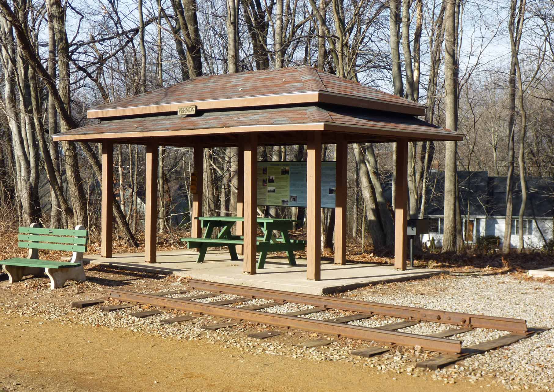
Talcott Ravine LoopThis moderate two mile hike begins at the Church Street Rails-To-Trails parking lot, follows the old rail bed to Talcottville, and returns along the Talcott Ravine trail. For a combination of geography, geology, history, historic preservation and biology this is probably the most interesting walk in the Tankerhoosen Valley. Vernon Depot
The walk begins at the site of the Vernon (also known as Dobsonville) Depot. The Hartford, Providence and Fishkill railroad opened to service in 1849 and went from Hartford through Willimantic to Providence. Two tracks came from Hartford to Vernon, but only a single track continued east. It serviced the area for 120 years. At the depot was a station, turntable, water tower and freight house. Just east of this site is the spur into Rockville. The history of the depot is told in text and pictures by Sierakowski and Lent on their Vernon Depot website. The two men did an exceptional job of gathering old photos and maps and researching the location's history. Railroad fans and hobbyists will also learn a great deal at this site. The town of Vernon has begun to outline the location of the buildings and there are now many interpretive signs and photos at the site. (See News Item.) » Go to Vernon Depot website for history and photos. Hop River Linear ParkYou'll follow the Hop River Linear Park Extension Trail from Vernon Depot to Talcottville. This is part of Vernon's Rails-To-Trails System, a nearly 6 mile trail along the abandoned railway from the Manchester town line to the Bolton town line following the Tankerhoosen River and Railroad Brook. It is owned by the CT DEP and leased to the town of Vernon, which maintains the trail. This section of the trail was completed in 1998. Shari-Ann Merton Memorial
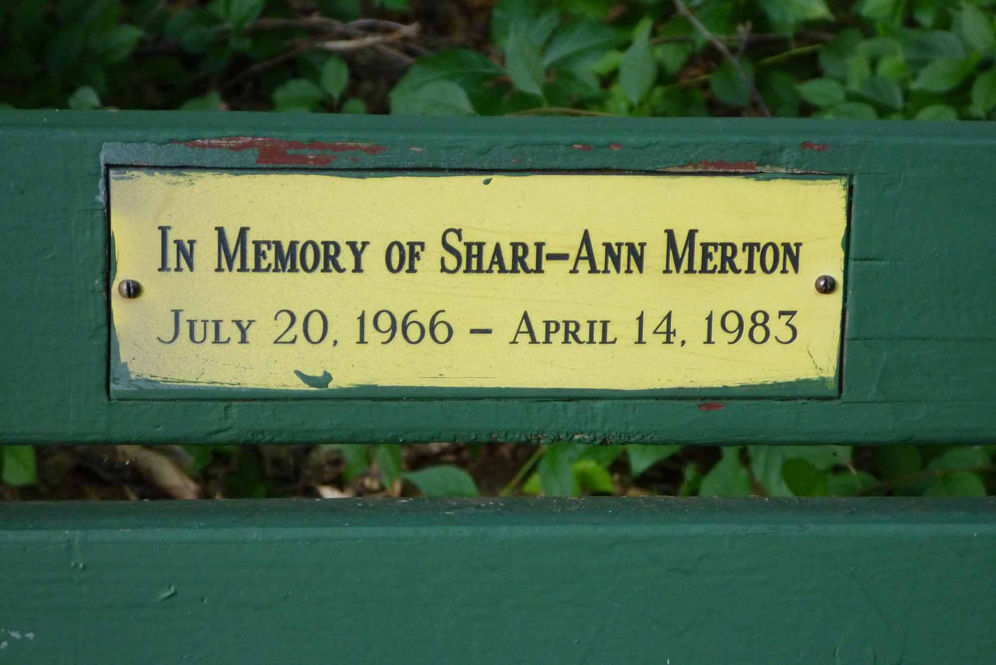
After you cross Dobsonville Road (which becomes Washington Street just to your left at the next intersection) you'll see a bench on your left with a plaque in memory of SHARI-ANN MERTON. Sixteen year-old Shari-Ann was murdered near this location in 1983 by her boyfriend COREY BARTON. The case generated a lot of controversy as Barton accepted a plea bargain from murder to manslaughter and was sentenced to 18 years in prison. He was released after serving less than 10 years of his sentence over the protest of her parents. Barton never learned to control his violent temper because in 1998 he was arrested in North Carolina and charged with the murder of his then girlfriend, 27-year-old Sally Harris. He pleaded guilty to second degree murder and is currently serving a 23 to 28 year sentence in North Carolina. » Read Hartford Courant story. Tucker BrookNext notice the brook far below passing underneath the rail bed. This is Tucker Brook, which drains the southeastern portion of the Tankerhoosen Valley. Its watershed includes most of the land west of Lake Street including a portion of Manchester. Unless you live in the area you may never have noticed this particular stream. It can also be seen at the intersection of Phoenix and Taylor Streets for those taking the back roads into Vernon. This is the last tributary to enter the Tankerhoosen River before it joins the Hockanum. It flows into the Tankerhoosen just above the Dobsonville Pond dam. We'll see that entry as we near the end of this hike. Ravine ViewYou are now just above the Talcott Ravine and should be able to hear the roar of the falls on your right. Paths are poor, but work your way down the bank for what is probably the best view of the ravine and dam. You'll also see some of the structure from Peter Dobson's mill, although it is easier to view from the other side that we'll come to later.
Man's Effect On The LandscapeAs you continue down the trail this is a good place to contemplate the changes man has made to the landscape - for better or for worse. As you come nearer to Talcottville the I-84 highway and the railroad bed converge reaching their closest point just before you reach Talcottville Pond. These two travel ways - rail and auto - straddle the Tankerhoosen River most of its length and dramatically changed the valley from the days when Native Americans camped and fished here. Before the railway and dam appeared Tucker Brook formed a ravine cascading down to the Tankerhoosen. Now you walk far above the brook. Fault Line
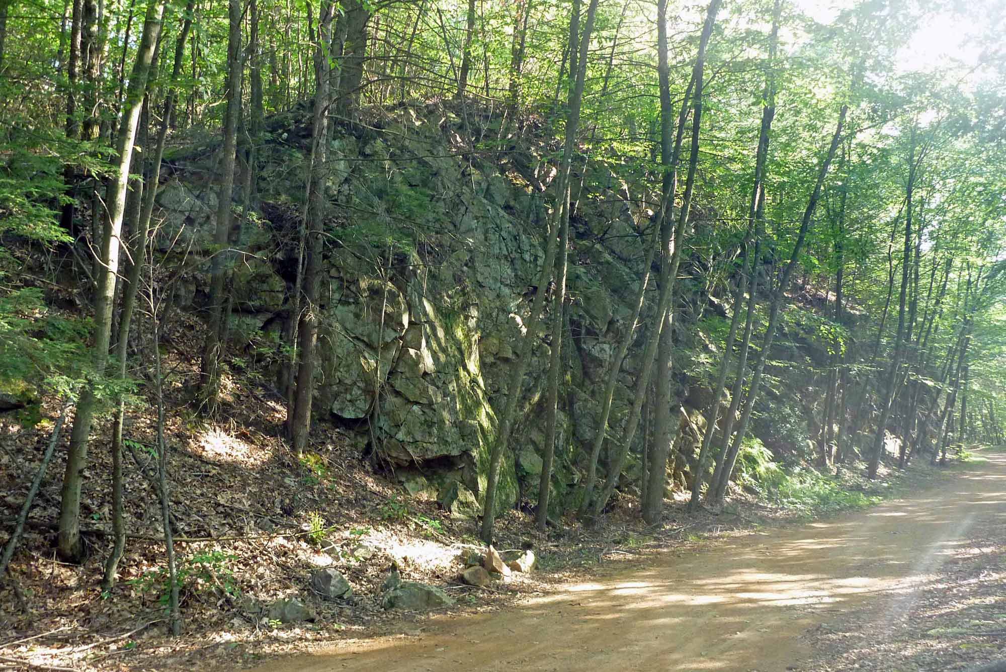
Just a little further along you see the second effect of man on nature as bedrock has been blasted away to make a path for the railroad, revealing the earth's skeleton. In this case it helps us to understand the geology of the area and how the land came to be as it is. Most of the Tankerhoosen Valley is part of the Eastern Highlands of Connecticut. Talcott Mountain on the other side of the Connecticut River represents the Western Highlands with the river valley in between. The Eastern Highlands are made up of a series of metamorphic rocks similar to granite. The section the Tankerhoosen Valley runs through is known as Glastonbury Gneiss. The Connecticut River Valley is Triassic sediments, which in most places are masked by a thick cover of glacial debris. The boundary between these two major rock groups is a fault that is visible along the rail cut. With a little help from a geologist we should be able to locate and identify the spot. Source: "The Bedrock Geology of the Rockville Quadrangle". See References. On To TalcottvilleAs you continue downhill toward Talcottville the woodland opens up on both sides and, if the leaves permit, you can see Talcottville Pond on your right. The woods in this area are the property of the Talcott family. When you reach the Elm Hill Road crossing you have the option of taking the road downhill to its intersection with Main Street at the Talcottville Church. A more interesting detour will take you through Talcottville's Mount Hope Cemetery. Mount Hope Cemetery
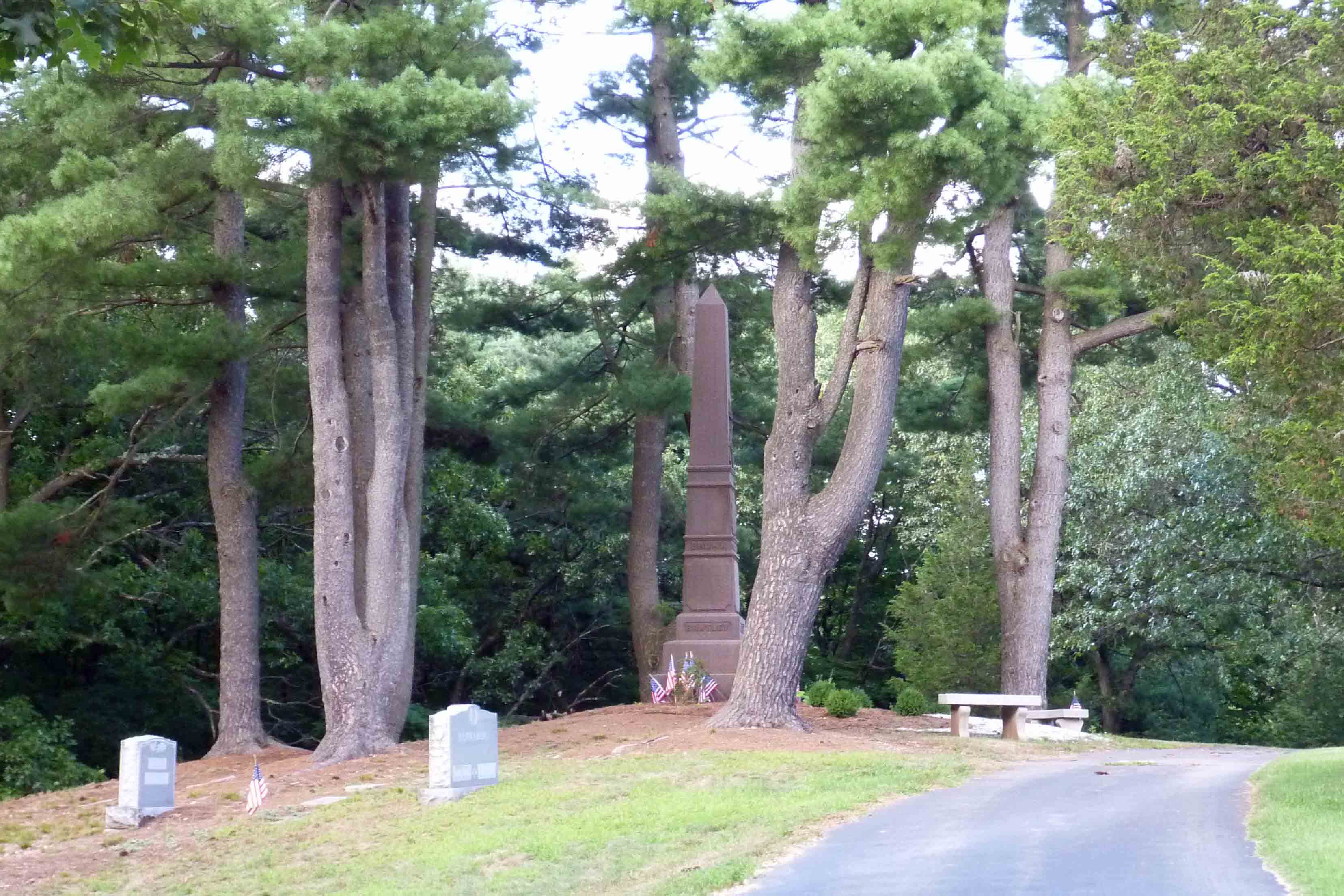
Mount Hope Cemetery is one of the best kept secrets in Vernon. I've hiked the trails and Ravine for over forty years and had no idea Talcottville had a cemetery. Until very recently there were no signs and the entrances double as driveways. Yet its a gem of a cemetery. To reach it continue across Elm Hill Road on the trail. You'll shortly see Welles Country Village senior housing on your right. As you step into the open look sharply to your right along the tree line and you'll catch a glimpse of the cemetery through the trees. This is one of the three accesses. The land was given by the Talcott family in 1867. Located on a hill, it is crested by a Civil War monument. You'll find many Talcott's buried here as well as other familiar Vernon names such as Skinner, Risley and Bushnell. For more photos go to Mount Hope Cemetery. After you've finished exploring leave the cemetery at the entrance near the monument, directly opposite where you entered. This will take you to Talcottville's Main Street. TalcottvilleThe village of Talcottville is on the National Historic Register. It was developed around and for the mills built on the Tankerhoosen River. Talcottville recently (2010) received a grant for street lights and informational signs that you'll find along Main Street. (See News Item.) The village's location just east of Route 30 and bounded by I-84 may have saved it from the development and commerce that destroyed so many other villages. Along Main Street you'll see the homes of factory workers, supervisors and owners; all still lived in and well cared for. Photos and text on the signs explain the history and major landmarks, so they won't be repeated here. Take your time and enjoy the sights as you travel the two blocks toward the highway and Talcottville Pond. » Go to Living Places for Historic District description and history. Talcottville PondCrossing the iron bridge you'll be in the pond area. To the left is the dam that powered the mill. The first house on the left is the 1803 home of early mill owner JOHN WARBURTON. The sign explains its history and unique architecture. If you only plan to visit the Ravine area you can park in the circle near the pond. It's a favorite place on a nice day to get away from work for lunch. Ravine Trail
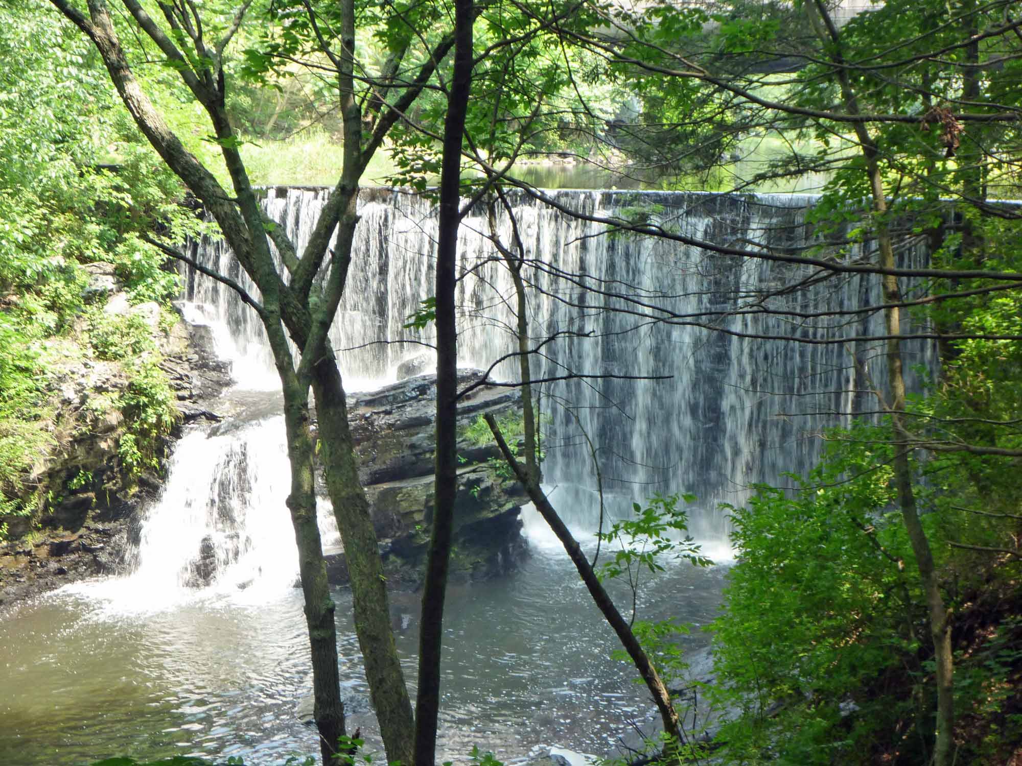
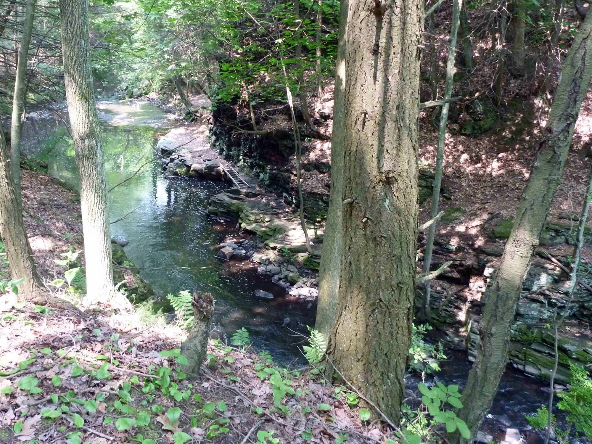
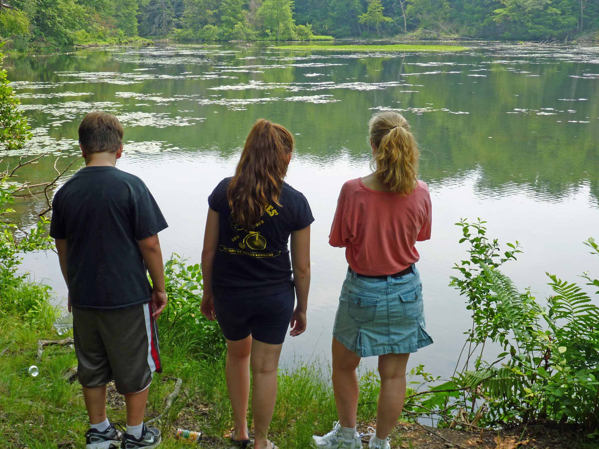
The Ravine Trail along the north side of the Tankerhoosen River from the pond to the ravine is flat woodland. On your left is the Exit 65 fly over constructed in 1980. This highway expansion took away half of the width between the highway and the river; another example of man's effect on nature. The river is at its widest in this area making it a popular spot for fishing. Along the trail you'll see evidence of beaver activity. This area is very picturesque during the summer and the autumn. Also note the gas pipeline that cuts through the area from north to south. You probably also saw it on the Rails-To-Trails path. The Talcott's gifted a 20 acre tract, which includes the river and ravine, to the Northern Connecticut Land Trust in December 2010 to ensure its preservation. The Land Trust is now responsible for maintaining the trail in this area. (See News Item.) As you approach the Ravine itself the trail forks. The right fork follows the river and accesses the Ravine, but is a dead end. Along this path you will see a mill race and old Indian cave on your right. Near the river a section of cliff has broken away making it very difficult to approach the dam. The NCLT is considering options for a bridge in this area. The RavineThe Ravine is the site of one of PETER DOBSON's mills and is probably the most scenic and unique feature of the river. It is just below the 26 foot Dobsonville Pond dam, has steep sides and you can see the remains of stone walls from the mill on both sides of the river. A separate page has been created for the Ravine area where you will find more detail and photos. » Go to Talcott Ravine description and photos. After visiting the Ravine return to the fork and climb the hill overlooking the Ravine. This will take you to Dobsonville Road overlooking the dam. Dobsonville Pond
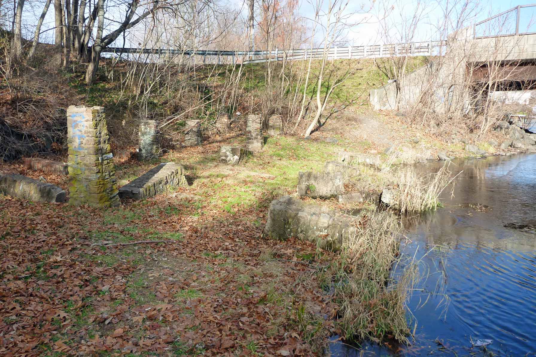
After climbing out of the Ravine and back to Dobsonville Road you'll be above the dam and can see clearly where Tucker Brook joins the river on your left. On your right are the few pilings that remain from the Dobson/White & Company/Addersly Mill. To see what the mill looked like when in operation visit Scott Lent's Mills On The Tankerhoosen River website. Crossing the street provides a good view of Dobsonville Pond, a 5.5 acre pond constructed in 1900 and owned by the DEP. The water in this lower section of the river is classified as Class B, while the upper section near Walker Reservoir is a Class A stream. From Tunnel Road west to Dobsonville Road there is housing built along the river resulting in contamination from fertilizers and other garden runoff. Go right on Dobsonville Road and just up the hill you'll reconnect with the Rails-To-Trails and return to the Vernon Depot parking lot. This walk shows a different face for each season of the year. After your first visit you'll likely find your self back here often. | |
Home | Activities | News | References | Search | Site Map | Contact Us © Copyright The Tankerhoosen. All rights reserved. |