 |
| Home | Geography | History | Biology | Recreation | News | Resources |
| Overview | Detail | Geology | |
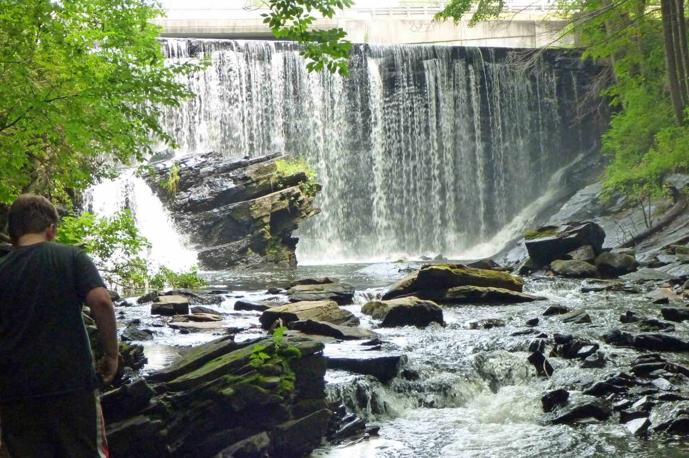
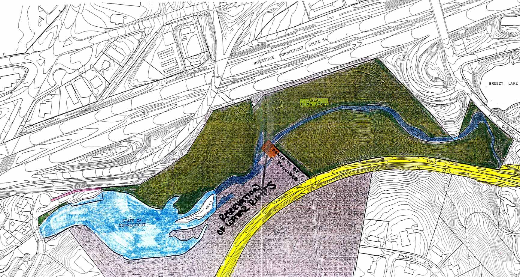
Talcott RavineJust below the Dobsonville Dam, located adjacent to Dobsonville Road, is the Talcott Ravine. The Ravine is the site of Peter Dobson's first mill and is probably the most scenic and unique feature of the river. Formerly known at the Talcottville Gorge, the 20 acre property was recently donated to the Northern Connecticut Land Trust (NCLT) by the Talcott family. The area is also within Talcottville Historic District. Description
The area is a largely forested, scenic area bisected by the Tankerhoosan River. The site encompasses a geologically significant gorge with steeply sloped rock outcroppings as well as the remains of early 19th century textile mills. The rock outcroppings form the gorge area about 30-50 feet deep. The masonry dam is 26 feet high with a length of 84 feet and was originally built in 1900. At one end is the dam and falls and at the other is the Talcottville Pond. Neither is part of NCLT's property, yet are an integral part of any visit to the site.
The land is characterized by a well-developed hemlock-hardwood upland forest, containing three to four stories of growth: an upper story, 35-65 meters high, creating an interlocking canopy of pine, hemlock, and mixed deciduous (oak and maple); a second story of saplings and smaller trees such as dogwood; a third story of scattered shrubs; and a fourth layer of herbs, mosses and ferns. Diverse habitats include wetland and pond aquatic habitats, stream habitats, and upland forest habitats. There is evidence near the pond of beaver activity. Approximately 15% of the area is wetlands, as defined by the Vernon Inland Wetlands Map; this area also contains a 'favorable aquifer area with saturated thickness greater than 30 feet'. Peter Dobson's Ravine
The site is significant for its association with Peter Dobson, an important pioneer of textile manufacturing in Connecticut. Peter Dobson built a cotton spinning mill on the Tankerhoosen River in 1809 which laid the foundation for the industrial village of Talcottville.In 1825, Peter was supervising the construction of his cotton mill when he became puzzled by the rounded boulders randomly mixed in with sand and clay that his workmen kept digging up. He proposed an explanation that was published the next year in Silliman's American Journal of Science. Dobson wrote, "I think we cannot account for these appearances unless we call in the aid of ice along with water and that they [the boulders] have been worn by being suspended and carried in ice, over rocks and earth, under water." This was the first theory published anywhere that suggested erosion and transportation by ice might in some way be responsible for the formation of till. The Mills
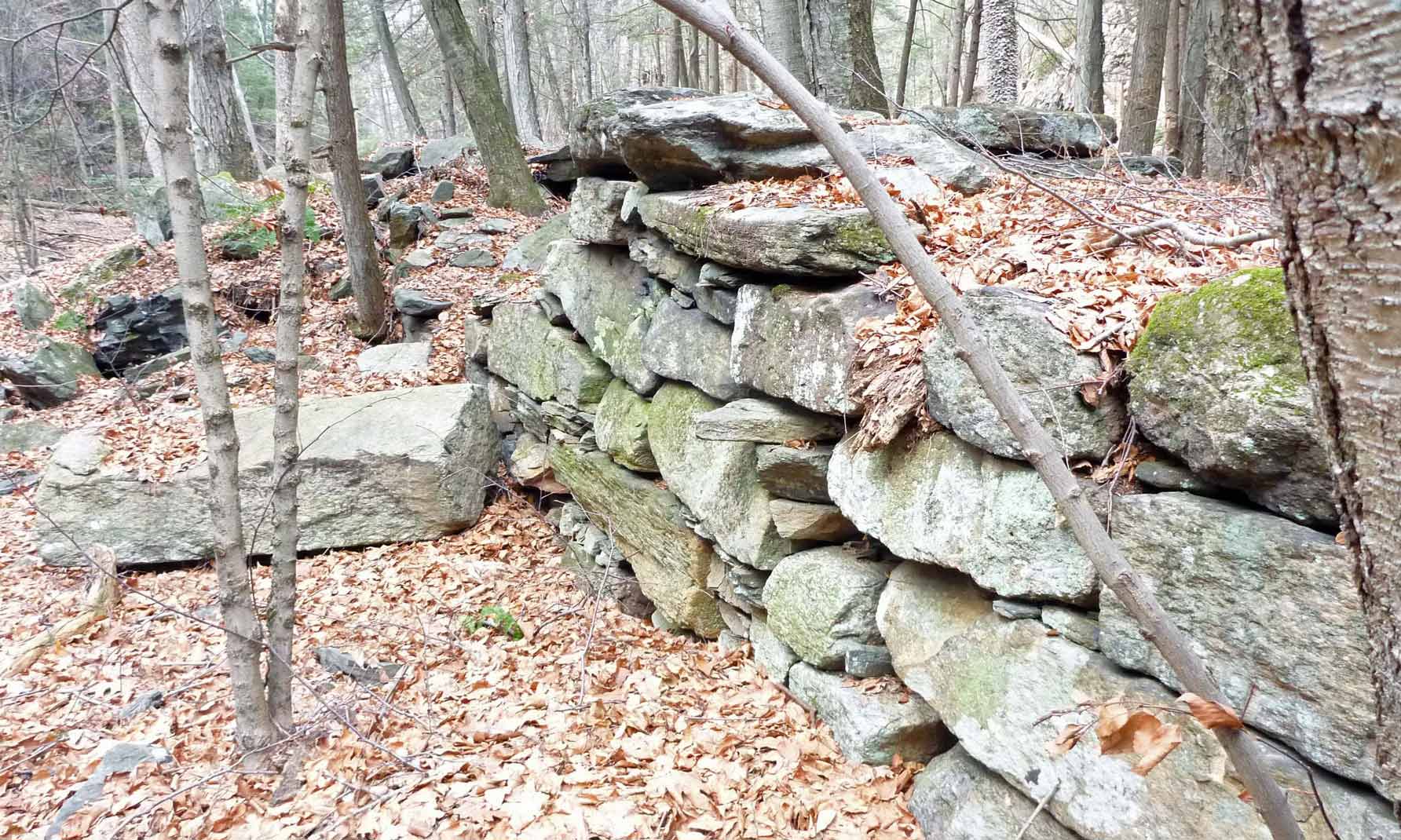
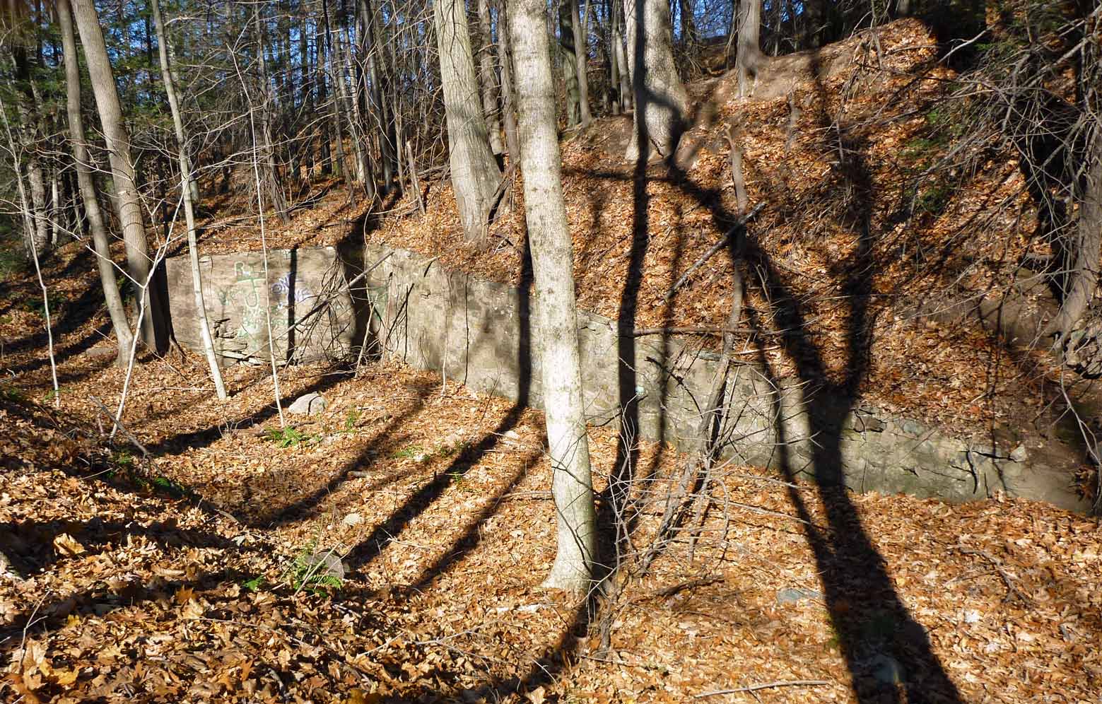
There were mills in the Ravine area from the time of Peter Dobson's 1811 first mill until the Ackersly Mill was finally torn down about 1939. A significant event was the 1869 flood which damaged or destroyed many mills in the area. For a full history with photos of the mills at this site see Scott Lent's Mills on the Tankerhoosen River website. The site of Peter Dobson's first cotton mill, the Ravine Mill, and a later mill built by Dobson to manufacture woolen goods, known as the Vernon Woolen Company, was the subject of an archaeological survey done in 1979-80 in connection with a state highway project. The Vernon Woolen Company had burned to the ground on October 12, 1909, and the mill was never rebuilt. None of the mill buildings were left standing and the site had been left undisturbed except for the removal of large pieces of machinery by the Talcott Brothers Company who purchased the property in 1926. During the archaeological survey, all of the buildings in the complex were identified and the site gridded. During the course of the survey, a considerable number of small machinery parts, such as, pieces of heddles and reeds, weights, gears, and frames, were recovered from all gridded squares. Many of these artifacts were found to be in an excellent state of preservation. The site is significant for its association with Peter Dobson, for the archaeological integrity of cultural artifacts uncovered in the survey, and for the association of the site with the early development of textile manufacturing in Connecticut. Preservation
The Ravine is worthy of preserving because of the need for water quality protection (wetlands and aquifer); wildlife corridor expansion; its historical and geological significance; its high recreational value; its very unique site and diverse wildlife habitats. The Talcott Ravine also has the potential to yield information pertaining to the early development of the textile industry in Connecticut. A stone dam, headrace and some foundations can still be seen. Significantly then, in December 2010 the Talcott Family gifted a 20 acre tract, which includes the river and gorge, to the Northern Connecticut Land Trust (NCLT) to ensure its preservation. The Land Trust is now responsible for maintaining the trail in this area. (See News Item). Walking The Gorge
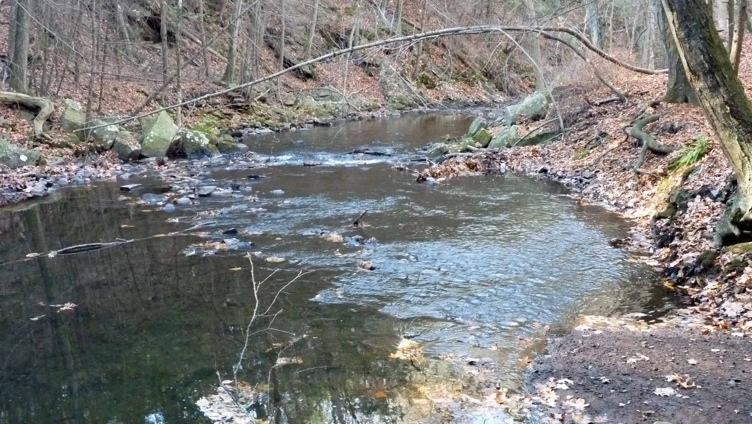
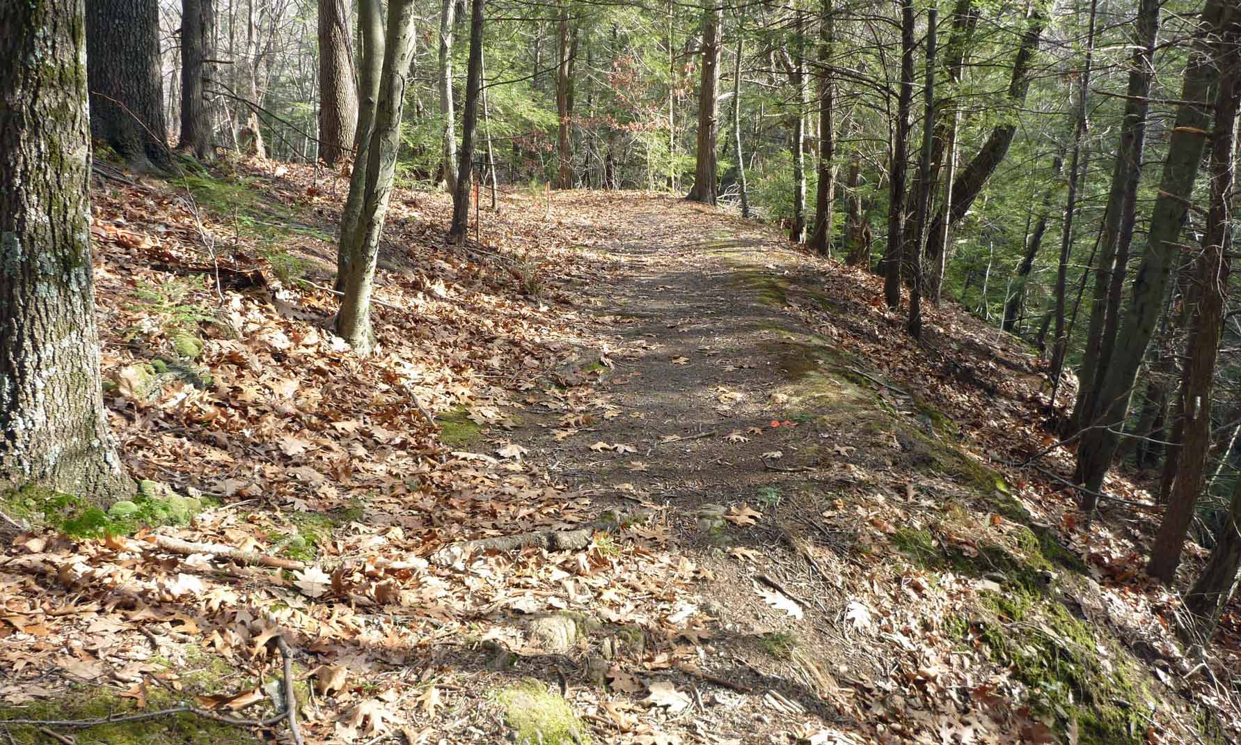
A hiking trail follows the north side of the pond and river linking Main Street in Talcottville and Dobsonville Road. By linking to the Rails-to-Trails pathway the 2 mile Talcottville Loop Trail encompasses the whole area. If you are walking just the Ravine Trail it is easier to park next to Talcottville Pond at the end of Main Street and walk from there to the Ravine and back.
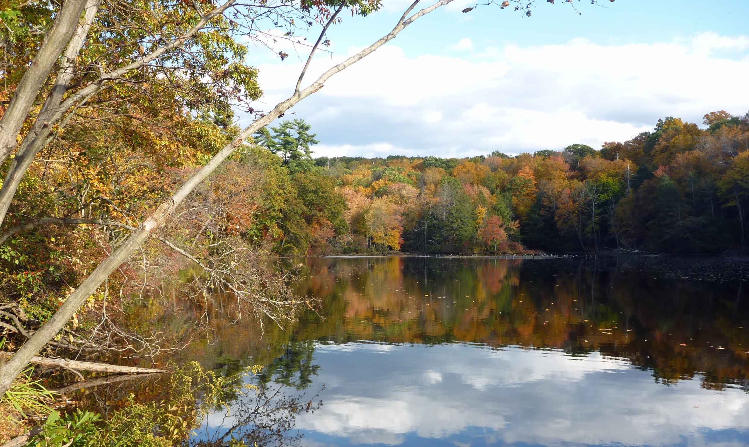
The trail along the north side of the Tankerhoosen River from the pond to the Ravine is flat woodland. On your left is the Exit 65 fly over constructed in 1980. This highway expansion took away half of the width between the highway and the river; another example of man's effect on nature. The river is at its widest in this area making it a popular spot for fishing. This area is very picturesque during the summer and the autumn. Along the trail you'll see evidence of beaver activity. Also note the gas pipeline that cuts through the area from north to south.
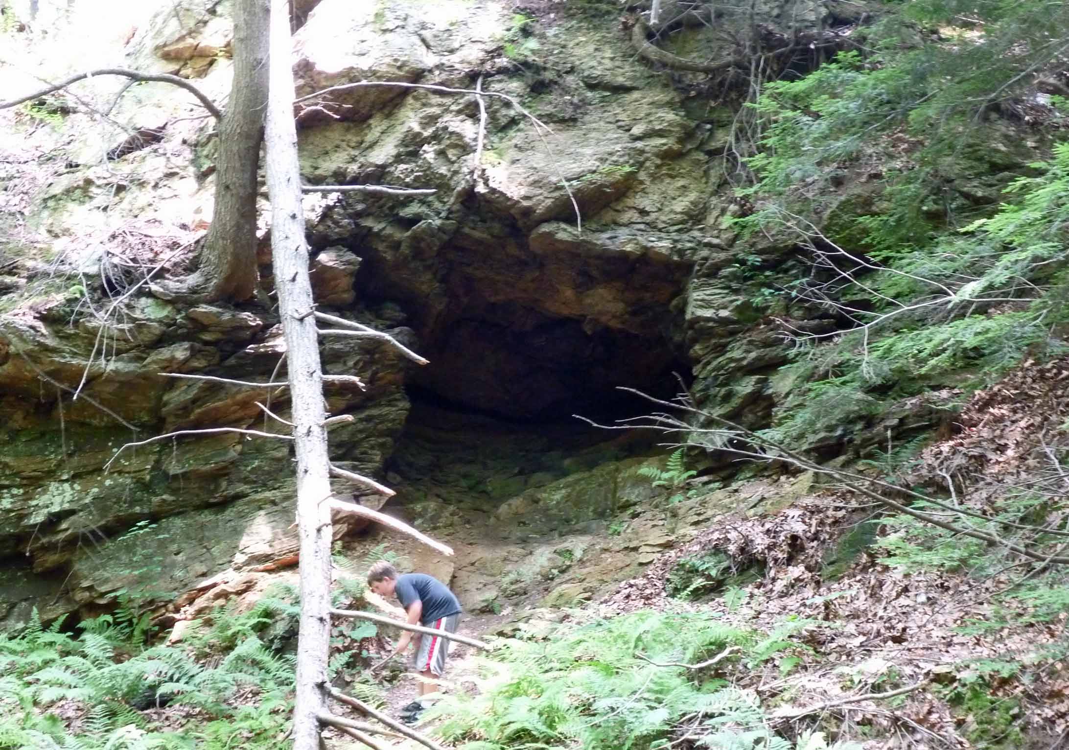
As you approach the Ravine itself the trail forks. The right fork follows the river and accesses the Gorge, but is a dead end. Along this path you will see a mill race and old Indian cave on your left. Near the river a section of cliff has broken away making it very difficult to approach the dam. The NCLT is considering options for a bridge in this area. After visiting the Ravine return to the fork and climb the hill overlooking the Ravine. This will take you past more mill ruins and to Dobsonville Road overlooking the dam. You can return along the same route or loop around on the Rails Trail through Talcottville. Source: Open Space Task Force Plan |
Home | Activities | News | References | Search | Site Map | Contact Us © Copyright The Tankerhoosen. All rights reserved. |